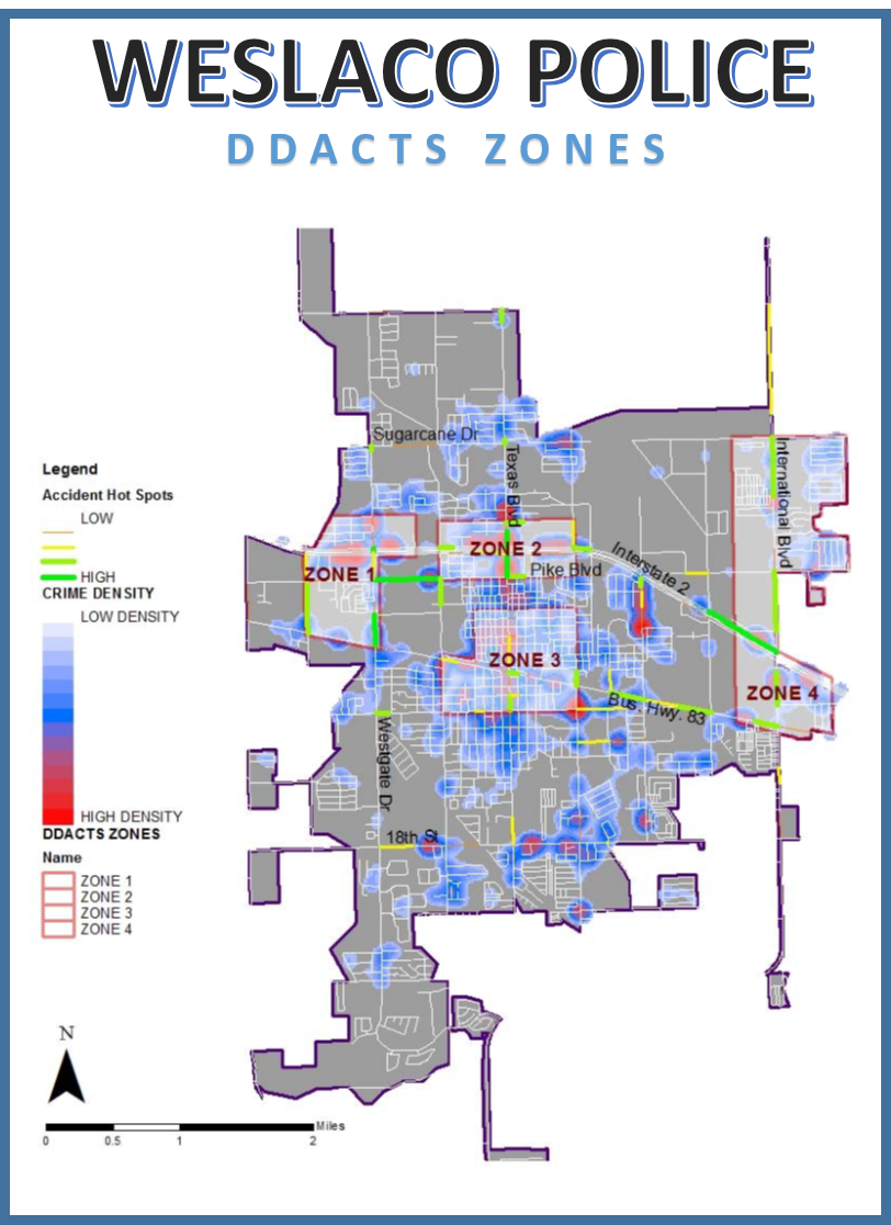
About Data-Driven Approaches to Crime and Traffic Safety
DDACTS integrates location-based crime and traffic data to establish effective and efficient methods for deploying law enforcement and other resources. Using geomapping to identify areas that have high incidences of crime and crashes, DDACTS uses traffic enforcement strategies that play a dual role in fighting crime and reducing crashes and traffic violations. Drawing on the deterrent of highly visible traffic enforcement and the knowledge that crimes often involve the use of motor vehicles, the goal of DDACTS is to reduce the incidence of crime, crashes, and traffic violations across the country.
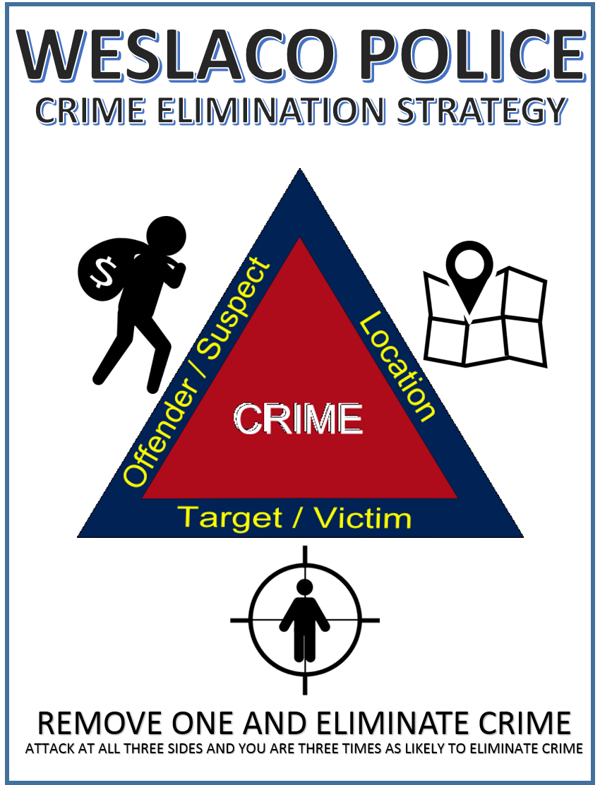
About the Crime Triangle
The crime triangle offers an easy way to visualize and understand crime problems. Three things must exist in order to have a crime: an offender, a victim, and a location. Lacking any one of these, a crime will not occur.
Example: A jogger runs through a dark parking lot and is assaulted by someone who has been lurking in the shadows.
Clearly, if we strategically eliminate one leg of the triangle, we also eliminate the crime. However, your chances of success increase if you can impact more than one leg of the triangle.
About the Strategic Analysis of Crime meeting:
Each week key department staff meet to analyze and respond to the various crime trends in Weslaco. Following a presentation from Crime Analyst Justin Gracia, Assistant Chief Walensky and all Department Lieutenants work out the details on how the organization is going to effectively target those crime hot spots.

CONTACT
Stephen Scot Mayer
901 N. Airport Drive
Weslaco, Texas 78596